Showing posts with label History. Show all posts

Friday, December 26, 2014

Memories of Tsunami

Ten years has passed since tsunami struck the coastlines of Indian Ocean, following the powerful earthquake with an epicenter off the west coast of Sumatra in Indonesia; the memories of tsunami are obvious like picking up shells from the seashore. Though I haven’t affected by the deadly waves directly, I was deeply disturbed and mentally suffered followed by the development of the devastation and scattered reports on mourns to death. There were even rumors (on the advancement of sea) to leave us into panic and living not far from the seashore, it’s impossible to avoid the uncertainty prevailed.

In memory of Tsunami victims!
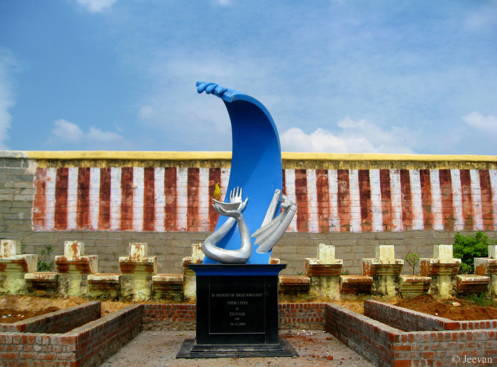
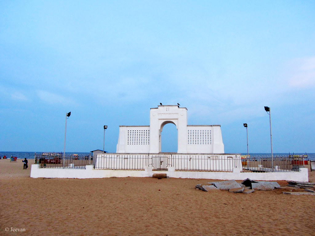
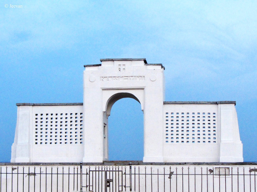
Memorial Icon of Tsunami in Kanyakumari
Being Sunday, we were asleep than usual and on hearing words something referred to tremor I couldn't continue lying on bed and come out to know what as my uncle asked me that I felt anything. There was an earthquake! But the tremor being so mild only those who were awake and living at certain elevation have felt the tremble and by the time I look at the street everyone where back to their places who came out in panic.  During the disaster we were staying in the first floor of our native house in Adyar, Chennai, hearing the news of tremor triggered panic even before the tsunami strike the coast or sorrow choke the throat.

My first encounter with a tremor/earthquake was in October 2001. Until then I have just heard of earthquake and know how it used to be only after seeing the Gujarat incident that happened on the same year. My expression and experience to tremor was funnier, perhaps not knowing how to react to such feeling/fear I scared so much and throw away the board on which I was painting something while sitting on the sofa. Since I was in caliper I could get out like others who rushed down as soon they felt the tremble, my mom and uncle hurried up unbuckle my shoes to lift me down. In few minutes all of us where on the street shoulder with neighbours.

My deals with tsunami were happen almost in front of the television, only my uncle was dare to go check with the Elliot Beach following the stroke with tsunami. I was staring at the television with awe, while the second longest beach in the world (Marina) enveloped in war of waves. The cars that have always seen running on roads where floated like boats in sea, with boats representing the parking lot. It was heartbreaking to see bodies being dragged to shore and people running towards the road to save their lives to avoid hitting the wall of sea.  The news channels where updated from time to time with the breakup of nature’s terror videos from across the southern countries.

Living close to coastline, I am sure each one of them would have a story to convey on their own related to tsunami whether they affected or not. During this course of tsunami, rumours were also spread to frighten us with the advance of sea levels into the landscape. I couldn’t sleep well for more than a week in panic, spending number of nights in uncertain thinking about the disaster and the visually seen in televisions/internet occupied the mind involuntarily. To relieve ourselves from the nightmare of tsunami and earthquake, we all spent the night of same in the single hall along with my uncle’s family to make not panic.
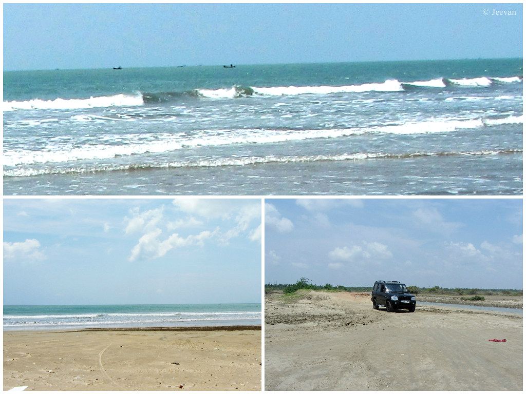
In the last 10 years I have covered 2/3 of the coastline of Tamil Nadu from Pulicat to Kanyakumari, we heard many stories related to tsunami during our journeys. While I visited Kanyakumari it was impossible to keep away the thought of tsunami and the videos and images were recollected when I sit watch the waves crashing the rocks. I felt unrest at each big wave arrive in force and the tourist boats making leap across them. Even it was fun checking some youngsters enjoy the strong waves and water splashes, something uncertain keep occupied. I also come across Manakudy, one of the worst affected villages in Kanyakumari where a bridge was washed away into the sea enclosed with number of death in the district.

The mindset was very similar even when I visited Velankanni, Cuddalore, Karaikal and Kodiyakarai along many other places aside east coast road (ECR), there are many villages in Tamil Nadu where one can find the traces of tsunami still exists reminding the one of the deadly disaster of our history. Many memories trigger while writing this post and experience with places that well relevant to the tsunami, but I couldn’t bring all of them here. I truly wish these incidents never repeat. 

Thursday, December 18, 2014

Karnataka High Court (Behind the Bars)

IMG_8556
Karnataka High Court, in Bangalore, though the fence.

The picture was shot (from the moving car) in 2011 when I was visiting Bangalore. The red building, known as Attara Kacheri in front of the Karnataka State Secretariat (Vidhana Soudha), is a two-storied brick and stone building painted in red. The Graeco-Roman style of architecture is a structure of vast expanse with lonic porticoes at the centre and at the two ends of the elevation.  

The building constructed in year 1868 was supervised by Rao Bahadur Arcot Narayanaswami Mudaliar. I link the post for Run A Round Ranch's Good Fences

Saturday, November 29, 2014

Parry’s Corner, Chennai

Parry’s Corner is a well known junction in Chennai, named after the EID Parry’s building that stands at the corner of the intersection of North Beach Road and NSC Bose Road near Madras High Court. Paris or Parrys is a household name among Chennaites, which is an important place for commercial banking and trading and also very famous for bazaars, is one of the most congested areas in Chennai. The NSC Bose Road has many historic buildings and EID Parry’s was the second oldest business house in India exists for more than 200 years.

Parry’s Corner
The EID Parry’s (India) Ltd., date back to 1788 when Thomas Parry arrived in Madras and registered as a free merchant and setup a model business of piece goods and banking. Acquiring the plot and garden house across the way from the High Court, Thomas Parry developed it as the office of Parry and Lane and remodelled the house in Palladian architecture. Followed by several partnerships the firm became Parry & Co in 1839, made it the premier house of business in the South and one of the leading businesses in the country.

EID Parry’s building
The EID Parry’s building, also known as the Dare House is named after John William Dare’s contribution to Parry & Co, as the most significant partner. He was recognised in the name of the Art Deco building that opened its doors on the Parry’s site in 1940, is now houses the headquarters of Murugappa Group. Next to the Parry’s building (on the NSC Bose Road) is the head office of the TNSC Bank.

TNSC Bank
The six-storied Art Deco building/home was built in 1970 on the pulled down of Ramalingam Building, owned by the Madras Provincial Cooperative Bank. By 1974, when the Bank moved into the new home it become Tamil Nadu State Cooperative Bank come head office.

NSC Bose Road buildings
Between the Anderson Church (see the steeple in left) and TNSC Bank on the NSC Bose Road are the buildings of State Bank of Mysore and LIC Bombay Mutual Insurance. Both the building sits on the site where the Anderson Hall and College exists once. The organisations also used the old buildings till their new once opened in 1957 and 1955 respectively. Interestingly both the buildings are constructed in Art Deco style and the Bank of Mysore (center) is architect by B.R. Manicam who was the architect of Vidhana Soudha in Bangalore.

Source of Reference : Hindu Metro Plus, The house that Parry built

Sunday, November 09, 2014

Vedaranyam – Renowned for salt and struggle

During my visit to Point Calimere (Kodiyakarai) we landed at Vedaranyam for temple visit and to time pass while waiting for the Point Calimere Wildlife Sanctuary to be open by afternoon to enter. Vedaranyam is a coastal town, about 50 km southeast of Nagapattiman in Tamil Nadu along the Coromandel Coast of Bay of Bengal. The town Vedaranyam derive its name from the temple here called Vedaranyeswarar Temple, with Vedaranyeswarar as presiding deity, is dedicated to Lord Shiva. The 7th century Saiva canonical work, Tevaram (written by Tamil saint poets known as the Nayanars) mentions this place as Tirumaraikadu, meaning the place where Vedas, the oldest scripture of Hinduism, originated.

Vedaranyeswarar Temple, Vedaranyam
Vedaranyeswarar Temple Tower (click photos for enlargement)
Vedaranyam is also a historical town and according to the inscriptions found in Vedaranyeswarar Temple, Vedaranyam has been a part of the Chola Empire under various reigns (from 871-1120 CE) until before it falls during 13th century CE while under a power struggle between Pandyas and Hoysalas. The Cholas had been profuse throughout their reign granting to the temple, which continued even during the rules of the Nayaks of Thanjavur. The Vedaranyeswarar Temple is a part of the series of temples built by Aditya Chola (871-907 CE) along the banks of river Cauvery to commemorate his victory in the Tirupurambiyam batter. The temple has a five-tiered gateway tower and a central shrine, holding the image of Shiva in the form of lingam.

Saltpans of Vedaranyam
Salt Pans of Vedaranyam
Being under French and British regime, like many other places in pre-independence era and a part of Nagapattinam region, Vedaranyam is renowned for salt and struggle! Producing around 500,000 tonnes of salt every year, Vedaranyam stands next to Tuticorin in quantum of salt produced in Tamil Nadu. Thanks to the advantage of Great Vedaranyam Swamp with total area of about 349 sq.-km stretching parallel to the Palk Strait and Point Calimere wildlife sanctuary to extreme east; Vedaranyam has five fresh water channels from river Cauvery draining into the swamp, that obtain continuous source of fresh, saline or brackish water during the southwest monsoon and dries up in summer, contributes to salt extraction.

IMG_0408
Salt Pans along the way to Point Calimere from Vedaranyam
The swamp is also filled by two periodical high tides that occur during the full moon days of summer. The saltpans spread over 11,000 acres between Vedaranyam and Kodiyakarai has small, medium and large salt manufactures that employ around 20,000 people. Aside salt manufacturing, fishing and salt water prawn cultivation is also primary activities of Vedaranyam. During the British period, salt from Vedaranyam has been transported to Nagapattinam port though a 52 km long canal since road transportation has been limited between these two towns then. Vedaranyam is a place that earned name for supporting Dandi March, one of the prime protest lead my Mahatma Gandhi against sales tax levied on salt extraction.  

I1092
Vedaranyam Beach
While Gandhi launched the Dandi March along India’s west coast to protest against the tax imposed by British Raj for salt extraction, his close associate and later India’s first Governor-General C. Rajagopalachari carried out a salt march in parallel, to the event on the east coast starting from Tiruchi to Vedaranyam. His group led by 100 volunteers was arrested by the British for collecting salt directly from the sea on the coast of Vedaranyam on 30 April 1930. There is a Salt Sathyagraga Memorial Stupe on the way to the Vedaranyam beach, built in memory of the salt march that sent Rajaji and others to six months imprisonment. Equivalent to Raameshwaram, taking bath in Vedaranyam beach is also believed to drive away sins! 

Thursday, October 16, 2014

Road experience and a day drive to Thiruvannamalai

These days the road travel has become frequent lose of signal i.e. vehicles come to standstill to every drop of red taillights even the traffic signal shows green. Heedless, we hit the GST road that too on the Monday morning hours has become a great setback towards the travel to Thiruvannamalai, which also delayed the progress. But glad it wasn't too late, since parent’s intended to be there before noon so that they don’t need to wait until 4 pm for the Annamalaiyar Temple to be open for worship. It has been a common rule in many big temples to close the corridor from public use between those times. If it was heavy traffic on the GST road (taking nearly an hour to pass the 10 km stretch between Chrompet and Vandalur), the road from Thindivanam to Thiruvannamalai is bad in condition. The road was cut a lot at many places and somewhere it was just single lane due to pending of road widening. The worst thing was there were no caution boards anywhere and the road suddenly goes down rough without a sign. It was so difficult maintaining a comfort ride, though I am a fan of off-roader, this kind of thing intrude when the intention was different.  My mother suffered a back pain coming out of this travel, though the road condition isn’t a cause quite but it could be one of the reasons to think.

Annamalaiyar Temple Raja Gopuram (Big Tower)
We reached Thiruvannamalai by 12 noon and the Annamalaiyar Temple was opened till 12.30 due to some ritual happening with the pre-Karthigai event. I stayed (as usual) at the car along with my cousin bro, while others went into the temple; it was a hot day and we parked the car at the open parking in front of the temple (from where I shot the temple tower) facing the majestic Raja Gopuram. At 217 feet in height with 11 stories, this temple tower is one of the tallest temple towers in India, and it was built by Krishnadevaraya of Vijayanagara Empire. We waited for nearly an hour under the hot sunshine, switching on/off the a/c and watching things happening around. I find a group of 4-5 aged women coming around the parked cars and asking for money, and I noticed that they were doing this like a business. They pick up 5 or 10 from each and equally share the money, and one of them even asked us for 1 ₹ change so that she could share fairy the amount. Even the one who appointed to collect parking ticket would miss one or two vehicles, but escaping from these ladies seems uneasy and they come blocking the vehicle when it’s suppose to leave.

IMG_8242
Sadhus of Thiruvannamalai
The parents return with cups of Puliyotharai (tamarind rice) from the temple, known that I like it so much and it taste was also really delicious. My aunt had brought lunch for us along with her from home and we bought Pakoda from the bakery and headed to the Girivalam road of Annamalai hill to have lunch. Girivalam is a Tamil word which “giri” refer for hill and “valam” means coming around.  Every full moon day people undertake a pilgrim by coming around the hill, which is 14 km in distance by road to come one full round. I like this road for which it travels partially on quiet, calm and green environment and being on this road already once, I couldn't think any other place (or best) to have lunch in a picnic format when questioned where? This road has number of benches to slabs (which are laid for the devotees to take brief rest while on their pilgrim around the hill) on both side of the road which helped us having lunch at comfort seating. I also saw many Sadhus sitting and sleeping on the pavements along the road, and as we feed couple of Sadhus who were resting and on foot, they blessed and wished us in humble.

While retuning on the same route to home, we took diversion at Chengalpattu to avoid the heavy traffic that lagged in morning as we experienced to never turn that side during morning and evening. We always encounter heavy traffic on GST road while coming into Vandalur, and to make it congestion happens the building of Outer Ring Rd. I have crossed Gingee couple of times while heading to Thiruvannamalai, but this time decided to stop at the foothill of Gingee Fort (Queen) on the northern side of the road to take few photos and brief on the area. The view from there was beautiful and enrich in green paddy fields and looking up the fort incredibly built on top of boulders hill! The way to the fort hill was inviting with lawn on both sides, but the closed gate doesn't seem to open to me even if I have brought my wheelchair along with this travel.  It was disappointing to see that many lakes and pools (along the way) were gone dry without traces of water. The Madurantakam Lake, one of the biggest in Kanchipuram district was quite desert look. But I was so glad to see a new flyover emerged across the railway crossing that connects Chengalpattu with Thirukalukundram and Kalpakkam.

Krishnagiri Fort – a part of Gingee Fortress
Gingeer Fort (Queen Hill)
It is a very important railway crossing and number of vehicle cross this gate everyday to reach other end towns. We have great experiences waiting at this railway crossing many times while visiting my great aunt who stayed at the suburb of Chengalpattu. Anything they want to buy has to come across the railway crossing after waiting long time for the railway gate to open.  The junction that called as Rattinakinarau has been totally different in circumstance now and I could apparently see drastic changes in the landscape on both the sides and new hope (light) sparkling all over. After long time I quite come across the Chengapattu-Thiruporur road with great surprise at the smooth road, which ever seemed to be same. Perhaps first time in the history of the creation of the road that took a new soft surface and wider in space. The Chengapattu-Thiruporur has been a single lane less than 5 years before and only a vehicle could pass at a time and one has to go off-road to give way to another. But now, glowing in surprise, the driving has become quite different on this road and any vehicle could overtake one other such easily and even two petrol bunks has sprout amid the forest and farmlands! 

Friday, October 10, 2014

Renovated Kaj Schmidt Memorial

A long time dream had come true by the renovation of Kaj Schmidt Memorial at Elliot’s Beach in Besant Nagar, Chennai. The monument erected in the memory of Kaj Schmidt, a Danish sailor who drowned in attempt to save the lives of three Europeans, which include two woman, has been abandon for long time and a huge crack was suppose to break it apart. But glad the Chennai Corporation had taken steps at last after various attempts by NGOs and public requesting the government to restore the memorial.

IMG_8211
I had been around the memorial number of times (while I was able to walk), without giving thought what it was and why built there. I also liked climbing upon the memorial through the broken steps and taking seat at the rear front that used to embrace in cool sea breeze. Getting close to the memorial never seems to be graceful unlike watching from distance and catching it during sunrise or sunset is always wonderful sight. Against the blue sky and sea, the renovated (not yet quiet) white monument beautifies the entire beach site, and it is also protected by fence on four sides.

The ambassador of Denmark who recently visited the monument revealed that Schmidt wasn't a Dutch national like we know so far, rather he was Danish! Schmidt born in Denmark in 1901, joined the East Asiatic Company in 1921 was sent to Madras to work at their first Indian office, which opened in (1928) hope to buy/export peanuts and market Danish dairy products and cement. Schmidt and his colleagues who went bathing to Elliot’s Beach on December 30, 1930, noticed people fighting the waves, jumped in and saved the people before he lost his battle. (check here for my early post detailing  the monument's exist)

IMG_8212
The monument unveiled a year later from his drowning, was built in honoring his dedication and savior attitude towards others.  The memorial originally a brick and mortar construction, and colored in Ivory was renovated using lime and stone for the lattice window and sunshades. The monument is stitched with stone to withstand so many years was done by Mamallapuram based sculptor and temple-restoration expert K. Rajendran and his six member team. The building without a stone foundation is now paved in granite sables to enhance the stability and prevent cracks.  


P.S. Photos capture by my cousin on my behalf 

Tuesday, September 30, 2014

Balamurugan Temple, Thandikudi (Fairly equivalent to Palani)

Situated atop a hill, shouldering with mountains overlooking the village, the Balamurugan Temple in Thandikudi is devoted to Lord Murugan and it is believed that only from here that Lord Muruga cross jumped to reach Palani, while he was anger with his parents over the contest between the siblings, to who own the Gnanapalam (wisdom fruit) by coming around the world. It is also believed that Lord Muruga stayed at this hill for some time, defeated the monster Idumban to convert him as his devotee before make Palani (one of the two hillocks which Idumban carried as Kavadi from Kailash) as one of his abode.

Balamurugan Temple, Thandikudi
Sri Balamurugan Temple
The Balamurugan Temple is said to be 2,000 years old, but the temple that exists today is built on the belief that Lord Muruga appeared in the dreams of Sri La Sri Pandrimalai Swamigal (a Siddhar or saint) and ordered him to build a temple for him on the Thandikudi hill, from where he cross jump to Palani.  He is also believed to show the exact place – where the temple is built – by lighting some torch on the hill, and the people who went there were surprise to see a footprint (which is believed to be Lord Muruga’s) on the rock and image of peacock gripping a snake on the adjacent.  Thus believed that Lord Muruga has went to Palani only from Thandikudi and the benefit of visiting Palani is said to be fulfilled only if they appear at Balamurugan Temple.

Green corridor of Balamurugan Temple
Quite tranquil environs of the temple
The road to the temple, that begins at the Regional Coffee Research Station passes through coffee and cardamom plantations. The temple situated at a height of 500 feet above the Thandikudi village, has pretty good road to reach by car or take a leisure walk. The slightly showered weather was refreshing while we drew on the newly tar road. It was also exciting to know that we passed a prehistoric site where megaliths were found, which we actually unaware until someone explained at the village. But later at home checking the photos, I find that we have shot some pictures on the site that lay beside the road, without knowing what it was.

IMG_4831
Fabulous view from the temple
The Balamurugan temple is also a wonderful panoramic viewpoint that overlooks the village of Thandikudi and surrounding mountains. The drizzling weather put me at hesitate, initially, whether to climb down or not the car to explore the place, but glad I did so and went around the pretty green and quite calm environment,  despite the voices of boys playing cricket outside the temple premises. There’s a small Ganesha shrine in front of the temple and it is a four pillared hall with idol enclosed in gate. The prime temple is also a hall based structure which was extended by curved sheet roofing and a small temple tower adorn with colorful idols and Kalasam (bass pot).

Shrine of Ganesha
Enclosed Ganesha shrining
The hilltop provides amazing photo opportunity to capture the village and cloud passing mounting from the side of temple, where the torch is believed to drag the attention of people to build the temple there. They have also built a room for the torch, which seems to light on special occasions and to give company to events, the temple has a gold coated chariot for procession. The rocks beside the temple said to have ever flowing natural spring, which revered as scared water. And sand found at a height of 75 feet from the temple is offered as Prasad to devotees. Just like Palani, devotees to Balamurugan temple also carry Kavadies during the festival of Panguni Uthiram.

Driving down the valley!
Driving down the valley (the road leads from the temple
Note on info:

Balamurugan Temple is situated at a height of 1500 meter in the Western Ghats of Palani Hills. Thandikudi is 40 km from Kodaikanal and Vathalagundu is 45 km and Palani about 92 km. The temple is open to public from morning to evening.  ( click location below for Google map on the place)

Wednesday, September 10, 2014

Thandikudi – A place where I felt quite tranquil!

Nestle amid the mountains of Palani Hills, at a range of about 1500m on the Western Ghats; Thandikudi is a pretty small village encompassed by coffee plantations, dense forest and mountain peaks keep it always cool and comfort weather to stay forever. I was so glad exploring this place last summer in June (2013) and the most fascinating thing I find there was bird watching. Though, Thandikudi is famous for Murugan Temple, coffee plantations and archaeological significant site, where Pre-Iron age burials are found. The pleasant weather and quite calm environment (where melodies of birds resonate) was something I never used before and deserves peace at best.

Thandikudi
Panoramic view on the Thandikudi village
Thandikudi is about 45 km northeast of Vathalagundu in the lower Palani Hills in Dindigul district of Tamil Nadu. The village is on half the mountains of Kodakanal, hence named as half Kodai, was reached partially driving on the Kodaikanal Ghat Rd and then take right near Ooothu and drive past Pannaikadu. Thandikudi is about 10 km from there. Though there are also alternate routes via Palani and Oddanchatram, apart Pattiveeranpatti which I preferred during my course of travel, since I sought for a change, this road comes as an isolate, fresh and traffic free unlike Kodaikanal Rd. It’s a pleasure on its own driving past dense forest and coffee plantations with few mountain villages making mild voices amid the chirping of birds.

Thandikudi,  a close-up at the village
Close-up on the village residence 
We reached Thandikudi in the evening, since began to climb the hill between 4-5pm driving all the way from Chennai. It started to drizzle slightly as soon we are on the narrow mountain road, and looking down the plains was then a sight of active rainstorms playing on the ground. Past Dindigul, the weather has been stormy making it only more exciting. We made a leisure drive across the winding ghats, just being cautious at the occasional opponents since the road is sufficient only for a vehicle to pass at a moment. The slightly wet condition then made pretty cool as the elevation rises slowly, we stop at the Mangalamkombu, a small village near Thandikudi, to pick a person who booked rooms for us at the Panchayat Kudils (concrete huts) for accommodation. 

IMG_4860
Mountains of Palani
Derived from the belief of people here that during the fight with monster Idumban, Lord Muruga jumped over the hill to reach Palani and thus obtained the name “Thandikudi”, which is a two, conjoined Tamil words meaning “cross-jump”. According to an archaeological survey, there’s one more reason to call it Thandikudi. The Kulasekhara Pandya inscription issued during the 12th regnal year (1280 AD) records this village as Tanrikudi. Where “Tanri” is a variety of tree (termenalia bellarica) famous for its medicinal value and found in abundance in this region and “Kudi” means a clan based settlement. The archaeological survey also suggests that the site lies in a perfect ecological background, which helped to occupy continuously for more than 3,500 years.

Green Coffee Beans
Coffee beans at Thandikudi
Thandikudi is a coffee hub, where the famous Leo Coffee brought their base there. The central government has also established a Regional Coffee Research Station (the sole kind across the state) there in aim of evolving suitable practices for the cultivation of coffee, since this areas come under the North-East monsoon influence with low rainfall and hence require set of package for cultivation. The Panchayat run cottages or huts (made of concrete) had also built their premises among the coffee plantations and canopy of trees provides quiet environment and enrich with birds sighting. Black pepper, orange and jack-fruits where also among the plantations thrive aside coffee in Thandikudi, the silver oaks too rooted strong base abundantly across the mountains.

IMG_4741
A screen of silver oaks
Thought Thandikudi is not a tourist destination, it too has places at receiving end. Except for the Balamurugan temple and certain view points (that come along roadsides) which we covered during our sightseeing, most of the places are pedestrian based or hiking. Although we managed to cover the area within a day, I still believe there’s much to experience and enjoy through personal exist. The Thandikudi chapter doesn't end here, but there will be more come into the blog through some other pretty posts. 

Friday, August 22, 2014

Happy Birthday Chennai

Our city celebrates 375th year of establishment today… here I share a couple of photos on one of the city’s oldest bridges, Napier Bridge.

Happy Birthday Chennai (Napier Bridge)
Also known as Iron Bridge was built in 1869 by Francis Napier, who was then Governor of Madras. The bridge was constructed over the Cooum River, connecting Fort St. George with the Marina Beach. Although the bridge was narrow before, it was soon converted to a concrete structure in 1943 by Arthur Hope.

IMG_7808
funny to see buffaloes across the bridge
Alongside the old bridge, a new one was built in 1999 with a 10.5 meter-wide carriageway on the western side. The bridge is 138 meter long with 6 spans (bowstrings) across the river near the mouth. As part of the Marina Beach beautification, special lights have been fixtures beneath and on the arches and surface of the bridge, provides visual effect during night times. This architectural marvel stands tall and proud, making it one of the most significant landmarks in the city.
 

Friday, September 27, 2013

My first tourist destination

Being a Chennaitie, my first tourist destination outside Chennai is perhaps Mahabs.  But Mamallapuram being my ancestor’s town I could not consider it as a tourist destination first and I have been there countless time and many a visit to the town has sighted in any of the sculpture site. My most favorite place then at Mamallapuram was Venna Tharatna Kal (butter ball) and we frequent there esp. to have fun sliding on the rock slopes.

Cheese ball
Krishna’s Butter Ball is a natural wonder, where a large rock boulder balance on the sliding rock surface is believed as a stone found on Krishna’s plate. The Pallava kings had tried to pull down the huge boulder with the help of their elephant force (thinking anytime the rock could roll down) but failed in their attempt. The lush green lawn in front of this rock (once an open ground for cattle to rest) take  one for pleasant calm and as a group to sit and chit chat.

I have been strolled behind the rock slopes and crossing the gaps between rocks and there was a well with green water, which was called Sita Kinaru (well) because it is believed that Sita bathed in that well. I have no pictures on them, but I still hold memories on those sight and there was also a path lead to our relative’s house then. I hope everything were blocked and fenced by ASI, doing wonderful job in protecting the sculptors and rocks. We never thought then these places will take such pleasant enhancement and flourish in green.

Arjunan Penance
Another place I liked and which is close to butter ball was Arjunan Penance. It is a giant bas-relief filled with marvelous carvings of various human forms and animals; the most fascinating part overall for me personally then were the Elephants. The sculptor of elephant couple and cute calves carved on the bottom of the bas-relief could be a favorite sight for any child and the pit reveal the bottom part was something dragged me then to look what is inside.

Monkey, looks for lice
Another pretty scene next to this site was a sculptor of monkey looking lice on another. As kids (me and my bro) we used to go and stand behind the sculptor and pose like looking lice on the monkey sculpture. Beneath the monkeys, there’s a small slide to play and a rock carved steps to climb on, but I don't like it much as the natural sliding near the butter ball. The slide was partially hid now after the earth rose because of the lawn making.

Footnote:

Just thought to write something for the World Tourism Day today and here’s a brief account on my first tourist destination out of Chennai.

Saturday, August 24, 2013

Heritages from heart of Chennai

The Chennai has number of historical building built during British administration still standing as landmarks of Chennai - the then Madras. The Chennai celebrated its 374 birthday on August 22, which commemorates the founding of the modern city by establishing Fort St George on a small piece of land acquired from the last King of Chandragiri in 1639 by the British East India Company. Here are few important landmarks from the heart of Chennai:

The heart of Chennai
The Chennai Central Railway Station, the main railway terminus in the city is a renowned landmark of Chennai and home to the Southern Railways - the most important rail hub in South India beside other major stations (Chennai Egmore and Tambaram). Trains from here connects almost major cities of India including the capital New Delhi, is also the main hub for the Chennai suburban railway system.

The railway station designed by Henry Irwin was built in 1873 at Parkown Chennai and it is a Gothic Revival style of building. The original station was designed by George Hardinge and consisted of just four platforms. The station was later modified with the addition of the central clock tower and other changes by Robert Fellowes Chisholm. The redesign was eventually completed in 1900 was further strengthened after the construction of the headquarters of the Madras and Southern Mahratta railways which is now known as the Southern railways of India adjacent to it in 1922.

Ribbon building
The Ribbon Building is an all-white structure, stands tall proudly on the west of the Chennai Central Station is the house of office of Chennai Corporation. The building is a fine example of Indo-Saracenic style of architecture, a combination of Gothic, Lonic and Corinthian is one of the landmarks left by British. Built in the early 1900s has been aptly named after Lord Ribbon, who can be considered as the father of local self government.

The building took a massive renovation in 2012; to preserve the original grandeur of: the walls were constructed with stock bricks, plastered with lime mortar and roof supported with teak wood joists. One of the main attractions of the building is the Westminster Quarter chiming clock which was installed by Oakes and Co.  in 1913. The clock has a mechanical key system, which were cast by Gillet and Johnston  has four bells.

Victoria Public Hall
Victoria Public Hall or the Town Hall is another historical building in Chennai, named after Queen Victoria. The hall, an example of the Indo-Saracenic architecture was designed by Robert Fellowes Chisholm in the Romanesque style is built by Namperumal Chetty between 1888 and 1890. The hall located on the current EVR Periyar Salai, between the Central station and Ribbon building was opened to public by Lord Connemara in 1887.

The hall was built to accommodate 600 persons, while a wooden gallery in the eastern end has seating arrangement for more than 200 persons. The structure consists of arcaded verandas, a square tower that is three storeys high and a carved pyramidal roof. There is also an intricately carved terracotta cornice, which resembles Islamic calligraphy atop the tower.

An unknown heritage building on Mt. Road, Chennai
PS. Sorry for the quality of photos, because they were shot from the moving car amid the interruption of Metro Rail Project across the view. (Source of info: Wikipedia)

Tuesday, August 06, 2013

Mettur Dam at brim!

The largest water basin of TamilNadu, the Mettur Dam has crossed the full reservoir level of 120 feet on Sunday night has widespread smile across everyone face. Just like a newborn baby, the over inflow of water in Cauvery River creates a celebration mindset across the state esp. the districts of delta which were left to drought for the last two years. The dam was last seen touching its maximum level of 121 feet in 2005 has took 8 years to behold a certain look, thanks to the southwest monsoon and heavy rainfall in the catchment of Cauvery lifting the water level that had gone down up to 15 feet in June.

Mettur Dam
The dam crossed 100 ft last week after two years gap, following Krishnarajasagar and Kabini dams releasing surplus water of 90,000, the outflow had reached over 1,00,000 cusecs. Also with the increase in discharge, the power generation by the Mettur Hydro power station has reached the maximum of 250 MW. Meanwhile people were issued warning through beating of drums in interior villages and people living along the water catchment area to move to safer place. It is just the monsoon and heavy rainfall in Karnataka that made possible filling up the Mettur Dam rather receiving the share of water in Cauvery.

In its 79 years of history, this was the 38th time the dam has touched the full reservoir level. The Mettur Dam is one of the largest and oldest dams in India and it is constructed in a gorge, where the Cauvery River enters the plains.

Mettur Dam, from the other end
I have crossed the Mettur Dam less than half a dozen times and explored it once after its Platinum Jubilee celebrating in 2010. The first image was captured from a view point, on the hillock adjacent to the Mettur Dam which supports the dam at one end and the other one was shot from the opposite side, overlooking Ellis Park across the Mettur Dam and less amount of water released through upper shutters. The water level was about 75 feet then! I have number of photos on the Mettur Dam and things to share which I will do later soon.

Sunday, July 07, 2013

Powershot Sunday - St. Stephen’s Church, Ooty

St. Stephen's Church, Ooty

“St. Stephen's Church in Ooty is one of the oldest churches in the Nilgiris district of Tamil Nadu. Stephen Rumbold Lushington, the then Governor of Madras, who keenly felt the need for a church in Ooty exclusively for the British, laid the foundation for the church on April 23, 1829, to coincide with the birthday of King George IV. St. Stephen's Church, consecrated by John Matthias Turner, Bishop of Calcutta, on November 5, 1830 was opened to the public communion on Easter Sunday of April 3, 1831. It came under the Church of South India in 1947.” - Source Wikipedia.

Footnote:

The picture was taken in 2011 during one of my visit to Nilgiris and I haven’t gone inside the church, but just shot it while waiting at Ooty collector’s office parking lot to get permission to drive through Avalanche forest. St Stephen’s Church is on the road to Mysore from Charring Cross.

Wednesday, April 03, 2013

Masilamani Nather Temple – Tranquebar

Masilamani Nathar temple

Just few meters away from the Danish Fort in Tranquebar, towards north, situated the Masilamani Nather Temple on the water splashing shore of Coromandel Coast of India. It’s the only temple on the land of colonial buildings, churches and bungalows! The temple looked like a mid-size shrine was constructed in 13th century under Pandyan Dynasty. Results from coastal erosion and salt breeze, the temple turned ruin in later days breathing life on the verge of Bay of Bengal.

After visited the Fort, we moved to the temple area through the newly laid platform from the fort entrance and moving close to rock shore, I felt cool, expose to mild drizzle cause by splashing waves. During our visit, the temple was going through renovation work and only yesterday I come across news in television about its completion supposes to be observed by a ritual. It was about 2 pm when we explored its ruins structure and restoring building adjacent to the main shrine.

Masilamani Nathar temple
It was a hot sunny day, but being close to sea we couldn’t feel the heat, instead I enjoyed the shelter of bright blue sky and sparkling sea and splashing waves along the rock shore. The temple is protected by both sides of rock seawalls, preventing the ruins getting more damaged. Below are the pictures showing the rock shores (on both sides) of the sea facing temple, cheering up with wave splashes, like holy water sprinkled on devotees.
Rocks Shore - Tranquebar
(The left hand side of the rock shore and the below is the right one on this east coast)
Rocks Shore - Tranquebar

Saturday, March 23, 2013

Paradesi - The Best!

There are very few films come up with a concept of period piece and recreate history exactly or feel close to real. In this front, director Bala’s ‘Paradesi’ (a pejorative Tamil term for wastrel) has took a special place in Indian film industry and within days of release (march 15) the film received National Award for Best costume design – by Poornima Ramaswamy. Inspired by a 1969 English novel ‘Red Tea’ by Paul Harris Daniel, the film upholds real life incidents of enslaved tea plantation workers of pre-independence India.

Director Bala, critically acclaimed for very unusual cinema has transported us to an era where the people of rural villages in the Madras Presidency are drove to work on British tea plantations with a promise of high wage and accommodation on contract base. But once reached, they are treated as enslave and pointing at their accommodation, food and medicine the supervisor cheats the enslaved to work on frustration and uncertain freedom. The film’s lead was unrolled by Adharvaa as Rasa, a carefree young tom-tom beater with half bald head – which is the state of most of men in the film hailed from village as enslave.

Alike Adharvaa, Vedhivka role is equally appraise for characteristic performance. The pretty actress has greased down gracefully, showcasing her acting skill which perhaps would wonder anyone who had watched any of her early pictures. ‘I guess everyone is equally talented and bringing it out is an art of either actor or director similar to student or teacher’. In this way director Bala had done incredible job by bringing or identifying the best out of actors and giving them change while exploring untouched plots.

The film also enclosed the struggle of tea leaf plucking; confesses the truth which is not easy as we see in tea estates, a pretty sight where women wore a basket on back and head covered in colorful shawl. One thing that impressed or impounds me in the film was the tone.  The dark yet low-light gave a realistic touch and brought down the more emotional and enslave scenes into less impulse. The music scores vital support to the film and songs come alongside the sequence is fair impressive and profound lyrics produces energy whiles lives at enslave.

Nowhere could I see an actor on screen and every character were so alive. The film run for more or less than two hour has very less dialogues, but the expressions and cinematography explains a lot. I recommend this film as must watch everyone and there is no language barrier here. Sorry I have no complains about the film, but indeed appreciate the entire team of Paradesi and its impossible without hardship and hats off to Bala to think different from any other.

Friday, March 08, 2013

PAP – Best Water Resource Development

Water, the chief ingredient of life is reliance upon rain. We can live even without eating for few days or a week but no life is survived without drinking or sucking water fall as rain. Life becomes trouble in case we took refrain drinking water for whatever reason such as hunger strike; though however noble it might be. Today obesity has drive people to drink plenty of water – which eases digestion and helps removing toxin from body. The advance technology in desalination has made alter routes for getting drinking water from sea, but the natural rainwater still holds lot of benefit on health enhancement.

It’s apparent that no life exists in earth without water and it’s a cycling process where trees help producing rain and rain as its resource. We man disrupt either by placing our self in front row, driving others as much possible aside by building endless homes and business to extreme anti-environment and producing immense population shrinking our  sources. The water was sought not only as a life source or health benefit but also to gain trust of vote in election. The politicians bear water as a vital element to score higher in election, no matter how people suffer or fought for life.

Parambikulam Aliyar Contour Canal
In Tamil Nadu the best water resources developments took place during the Kamaraj’s administrative – the former chief minister of TN; who widely known as Kingmaker in Indian politics, who’s tri-tenure or the nine years administrative (1954-1963) as CM of TN were considered as golden period. During his regime witnessed number of dams built across the state and each one of them were an engineering marvel. The uneducated genius - Kamaraj - plays a pioneer on interconnecting rivers and his head of administration has dug number of tunnels diverting the water to utilize fully.

Among the many major plots he charted on irrigation front, feeding thousands of acres of lands across the state, the 'Prambikulam Aliyar Project' is notable! Carried out on the state boarders of Tamil Nadu and Kerala, PAP is a multipurpose and interstate river valley project diverting and integrating the eight west flowing rivers to the east side to the then drought pone area of the Coimbatore and Erode districts of TN and Palghat of Kerala.  The irrigation network consist of seven major canals, comprising one diversion weir,  seven storage reservoirs, conveyance system and interconnecting tunnels to divert water impound to the plains of Coimbatore and Erode.

Contour Canal
Except the three reservoirs slip into the Kerala state, I have drawn to five of the seven reservoirs lie at various elevations ranging from  +3800 feet and +1050 feet across the Anamalai Hills. Lying at difference in elevation has also made it possible for these reservoirs to generate hydro-power. The Aliyar Reservoir built across the Aliyar River at the foothills of Valparai has its source in the Anamalai Hills. Apart its own catchment area of about 76 Sq. Miles, water to this reservoir is diverted through the Aliyar Feeder canal and the Contour canal from the Parambikulam group of reservoirs.

What you see in these photos is the Contour canal rode from Parambikulam, which is one of the major canals running for a total length of about 250 km. apart various branch canals, distributaries and minors through which about 4.25 Lakhs acres of lands get irrigated. About 5 km from Aliyar Dam, we saw the contour canal crossing the road to Valparai, and this canal carries water to Thirumoorthi reservoir about 35 km from here. The water was at its full fledged during our uphill ride and we stopped there for a while, while our relative explaining its progress. It felt something wonderful when looking at the fresh water rushing through the canal and fact that they pass number of tunnels lasting certain kms into hills. 

It seems one of the best sharing projects so far between the states with no major issue based on sharing. To note a point, the PAP project had carried out quite throughout IndiraGandhi Wildlife Sanctuary and National Park which beholds number of endanger and wild animals. It doesn't sound easy for me to dug deep tunnels into the haven of wild animals and infectious insect bites… and in time when everything was suppose to done manually. I couldn't stop praising those heroes involved in this project and the engineers with amazing talent on finding routes. 

Wednesday, December 26, 2012

கடல் அம்மா / Marine Mom

Folding wave
Pic by Jeevan (cick to enlarge)
ஏ கடல் அம்மா
உன்  சிறுபிள்ளை  நங்கள்
மடியில் தவழும் பிள்ளைக்கு
நீ  கள்ளிப்பால்  ஊட்டலாமா?    

தாலாட்டு பாடிய அலைகள்
ஓசையின்றி  ஒப்பாரிவைகலாமா?
கதைகள் கற்பிக்காத பிம்பம்
கண்ணிமைக்குள் மூழ்கியதே 

தான் விரித்த வலைக்கு
தானே இரையான கோரம் 
வாழ்வளிக்கும்  வள்ளல் நீயே 
உயிர்  பசி ஏனோ?

சுனாமி என்னும் அரக்கனை அனுப்பி
வதம் செய்வதேனோ ?
கண்ணீர் சிந்த யாருமின்றி 
கொன்றுகுவித்து விட்டானே .

A marine mom
we are your child,
how could u feed venom
to a kid crawling on the lap?

The lullaby sung waves
how become quiet threnody?
The stories untaught simulacrum
submerged into the eyelids.

To the expanded web
to become a victim of horror
being a brought up philanthropist
why hunger for life?

Sent a monster tsunami
why you slew?
To no one to shed tears
he killed everyone to hump.

P.S. A tribute to tsunami victims, wrote from a fishermen’s perspective. 

Monday, October 08, 2012

YMCA Building

YMCA building
Last year I come around the core area of Chennai, the so called Mount Road, Central and Parrys and got to capture some remarkable buildings and landmarks of Chennai; and one among them was the YMCA Building. Young Men’s Christian Association building is an architectural marvel located on the NSC Bose road in Esplanade; and it was the first building to be built in Madras at the request of then Governor Arthur Have-lock in 1900.

YMCA building, built in Jaina-Jaipuri style
YMCA Esplanade is the oldest branch of the Madras YMCA, established in year 1890 by an American Secretary Mr. David McConaughy in the South Indian State of Tamil Nadu. YMCA is a Jaina-Jaipuri style of building, began its work in 1895 was completed by a donation of $40,000 by John Wanamaker, the then Post-Master General of the US. The building was designed by G.S.T Harding and it is one of the oldest heritages of Chennai – the then Madras.

Tuesday, October 02, 2012

Mahatma Gandhi Memorial

(Click image for enlarge)
Mahatma Gandhi Memorial is constructed on the seashore of Kanyakumari - the southern tip of India, where his ashes were kept for public view before immersion in the sea on February 12, 1948. The Gandhi Mandapam is built in Orissa style of architecture and designed in a way that the rays of the sun falls exactly on the place where the urn was kept through a hole on the roof, on his birthday of October 2nd.

The beautiful Gandhi Memorial completed in 1956, is situated as a memorial to the Father of the Nation; and its central shape is 79 feet high representing the age of the Mahatma. The memorial was transferred to the administrative control of the Public (Information and Public Relations) Department from Public Works Department of Government of Tamil Nadu in the year 1978.

Footnote:

We visited Kanyakumari last year end and I could only view the beautiful exterior of the memorial from road, since there are few steps leading down the entrance. I capture few photos on the memorial but due to lens problem then I couldn’t get a clear picture, so borrowed the first one from my cousin and the 2nd one was the only better I could take, with mom and grandma standing in front of the memorial.